Follow the Signs

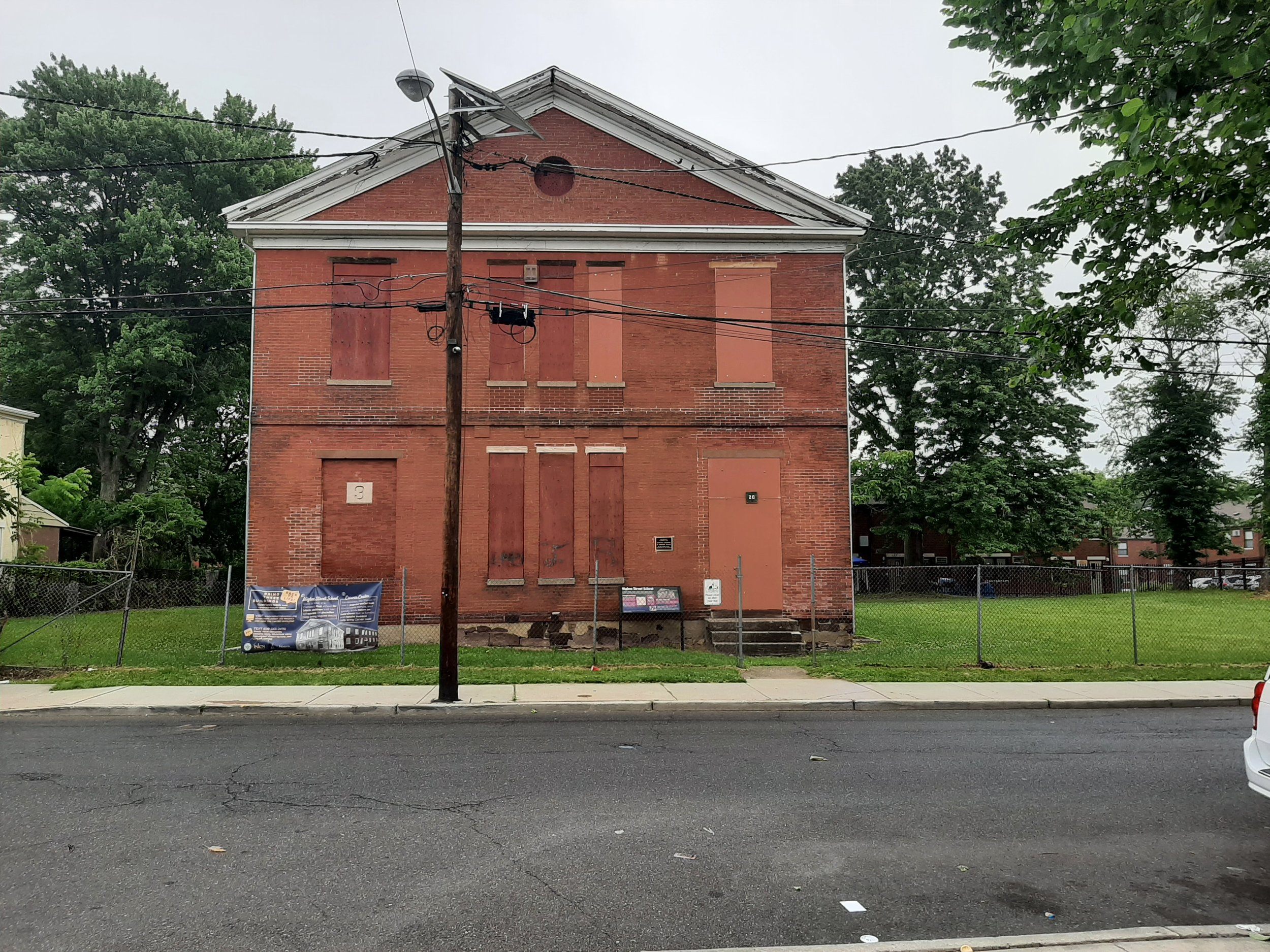
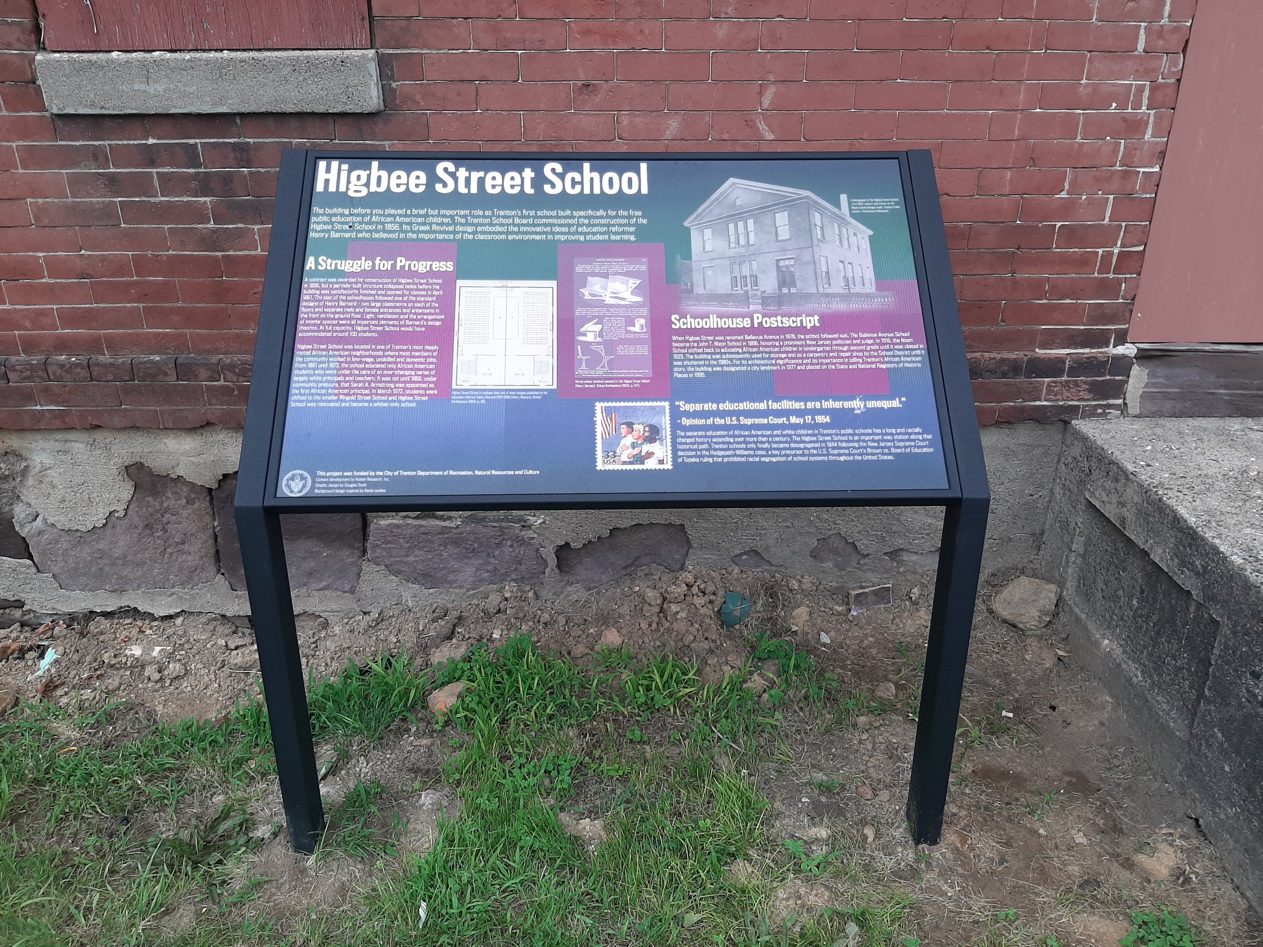
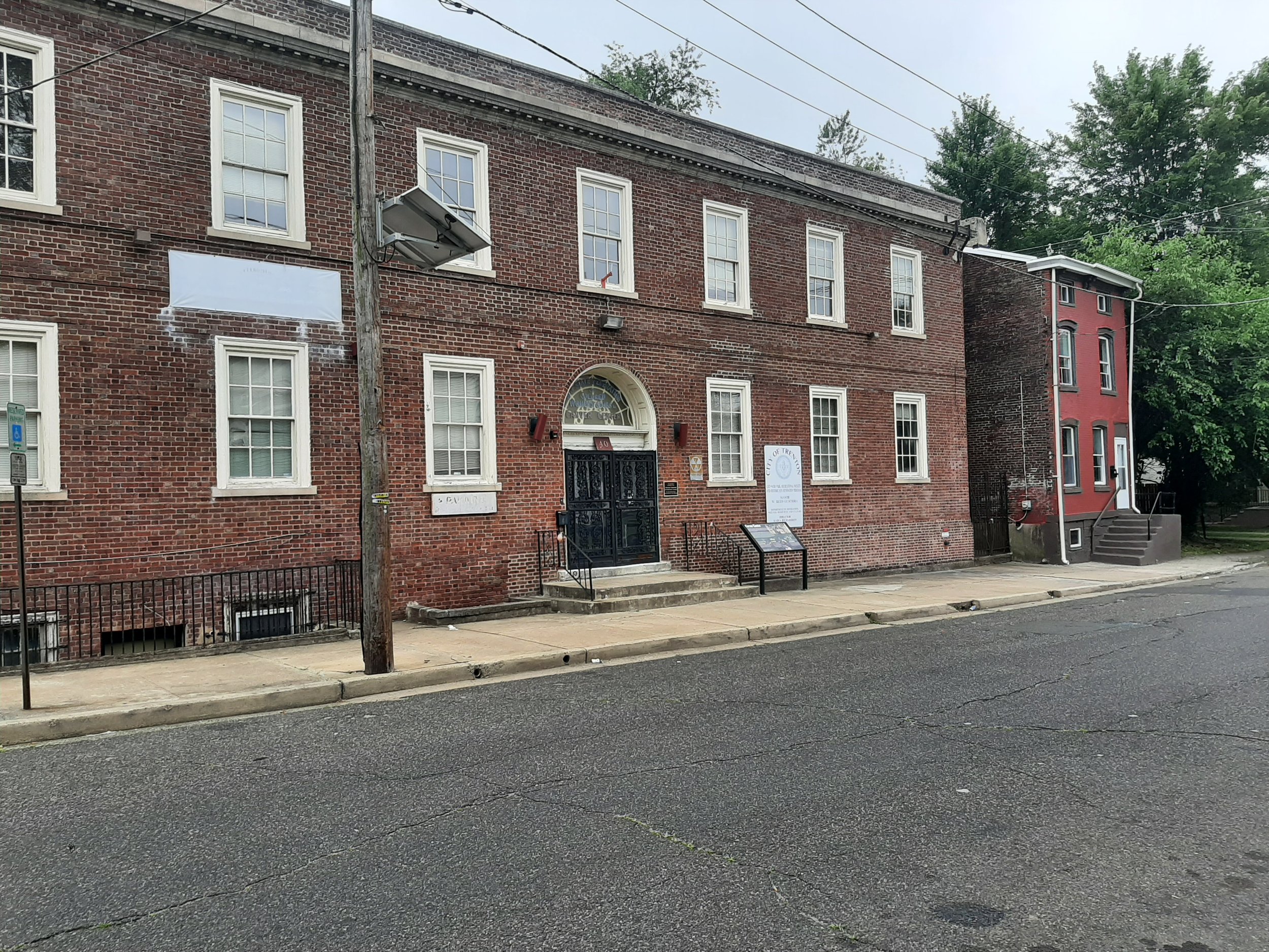
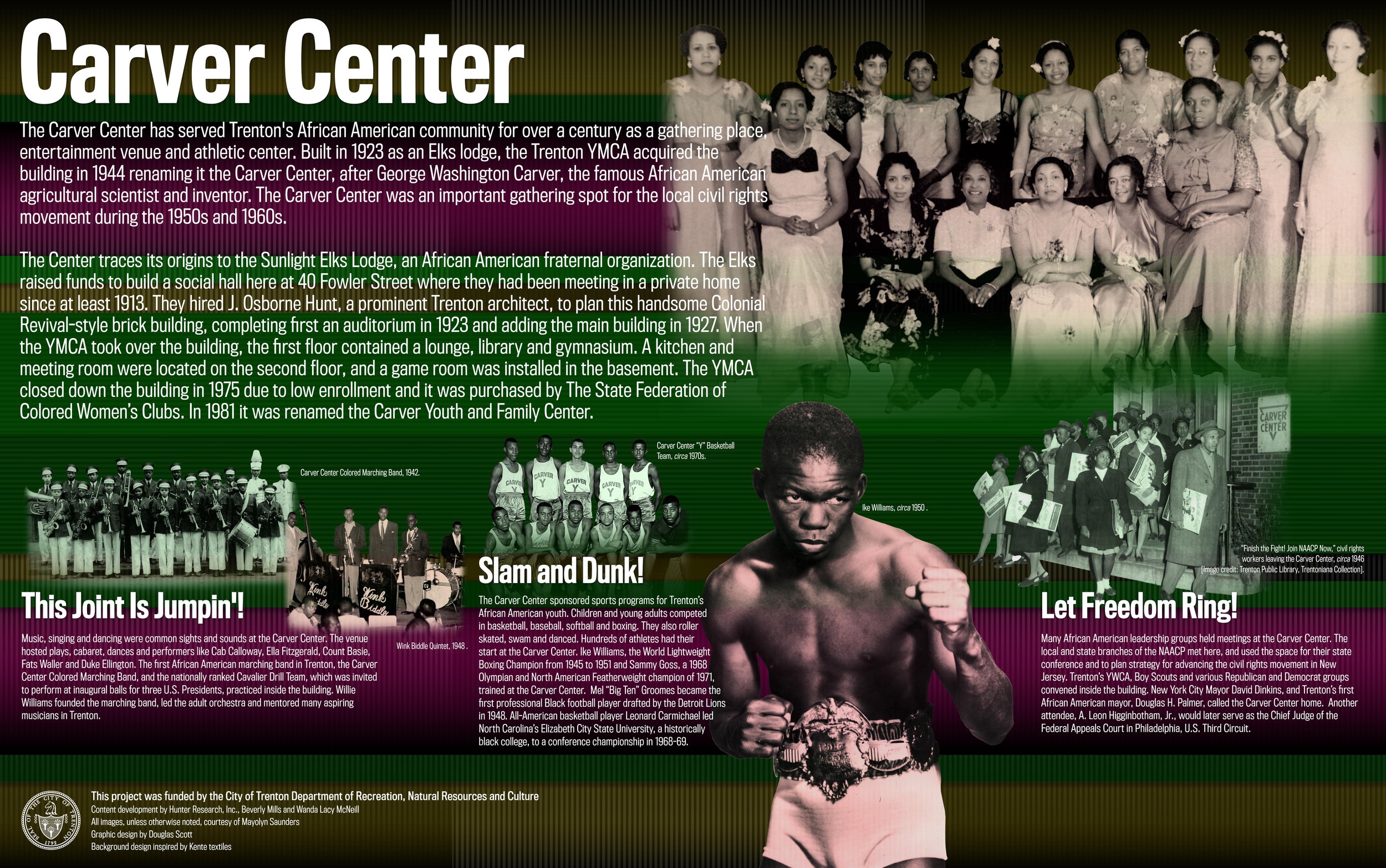
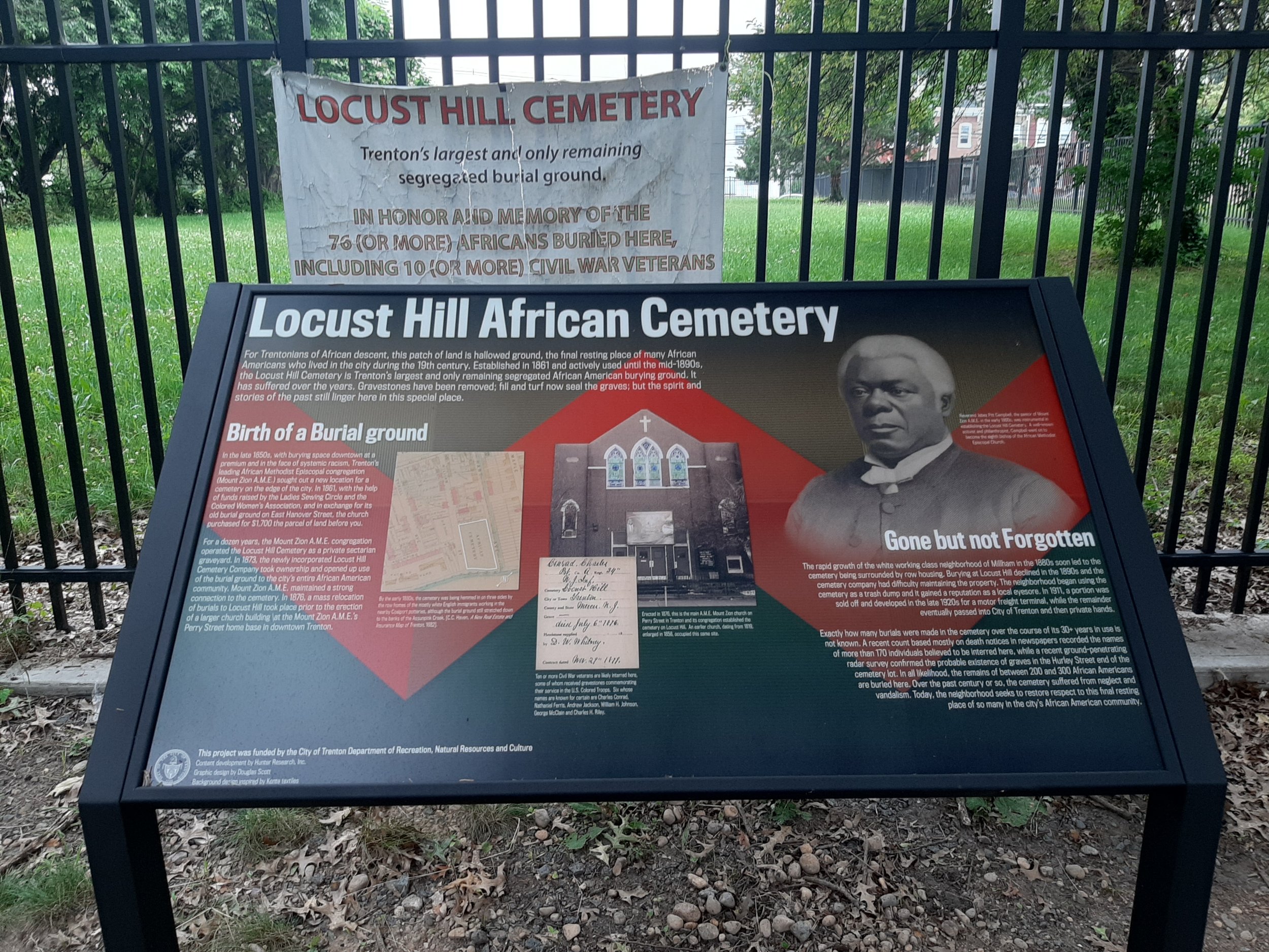
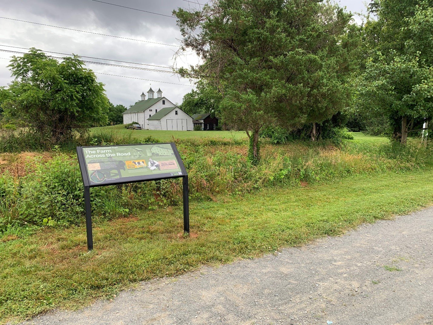
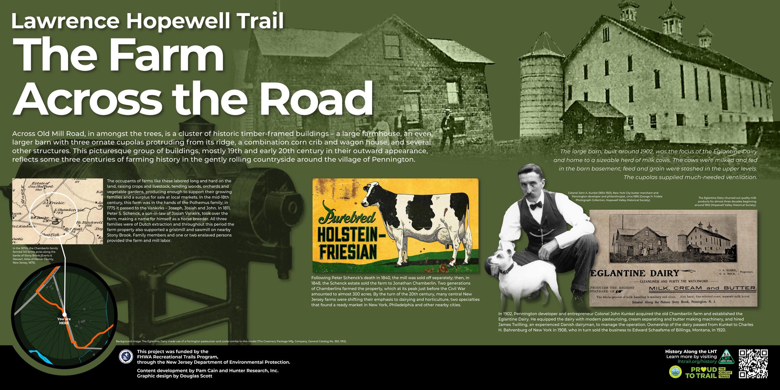
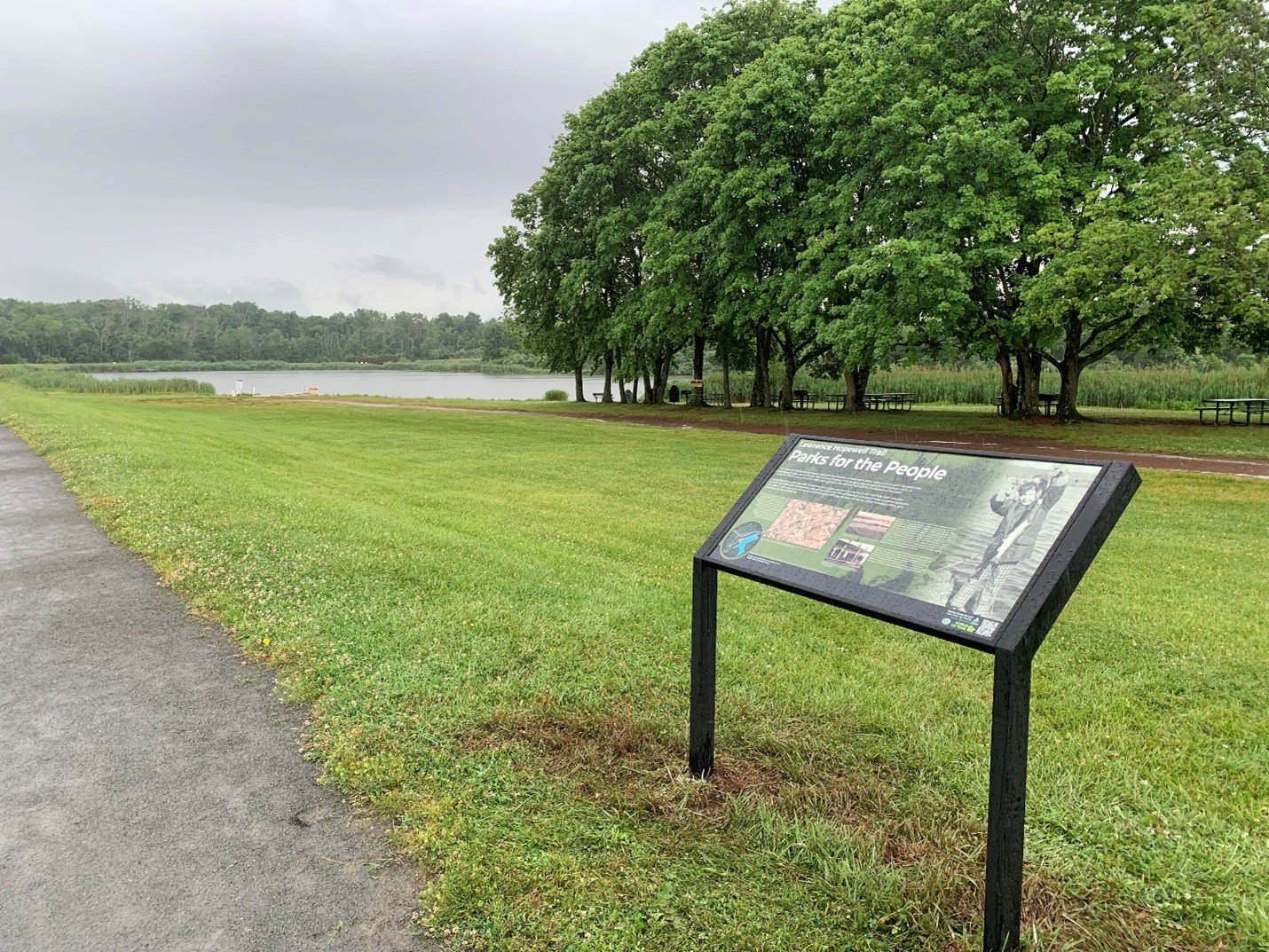
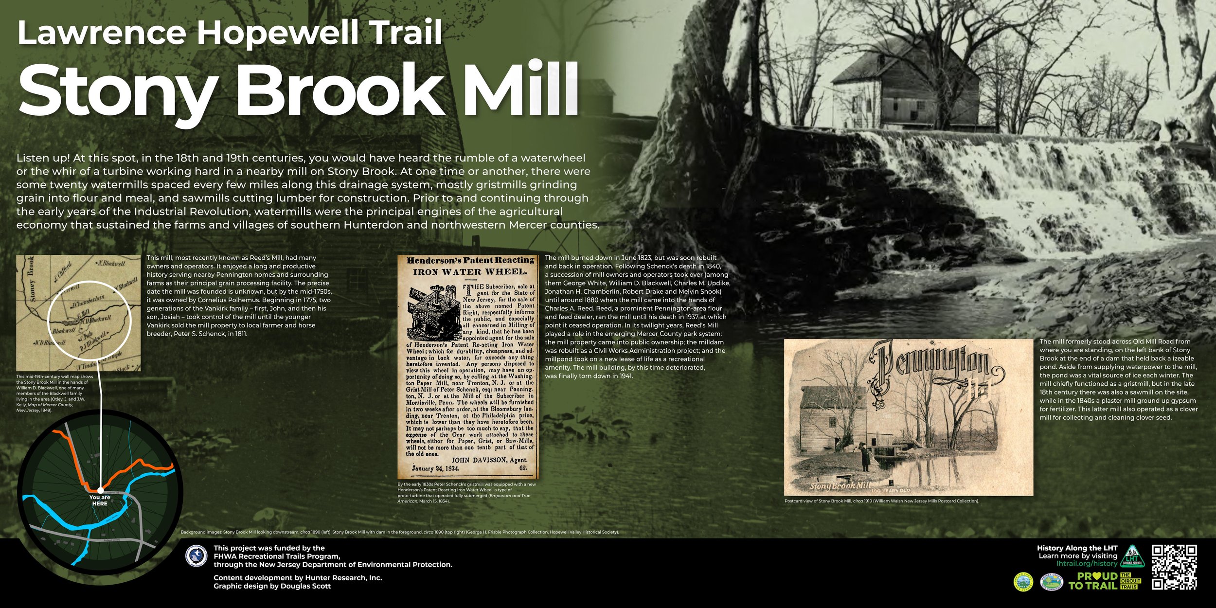
Hunter Research continues to nurture a productive side line in historic interpretive sign design.  Over the past five years, mostly working with graphic designer Douglas Scott, our firm has completed signage for a number of choice historic sites, most notably Seneca Village in Central Park. This past Juneteenth a group of signs along with National Register of Historic Places plaques were unveiled at three of Trenton’s most revered Black landmarks – the Carver Center, the Higbee Street School and the Locust Hill Cemetery. A week later, five more signs were added at historical and geographic points of interest along the 20-mile Lawrence Hopewell Trail in the Princeton vicinity of New Jersey – a couple of mill sites (one with an iconic Warren pony truss bridge), a farm, a park and a drainage divide. Visit the history page at the LHT website for more information [link].

Meanwhile, several more sign projects are in process and will reach completion in the coming months.  Among these are a family of signs for the William Trent House, a National Historic Landmark property in New Jersey’s capital city; a pair for the Divident Hill Monument in Weequahic Park in the City of Newark; and one on either end of the historic bridge crossing the Connecticut River between Lancaster, New Hampshire and Guildhall, Vermont.  We view our signs as history’s friends, connecting the present and past for a decade or two into the future, and grounding us in the immediate reality of place.

Mount Zion AME Church Listed in the National Register

In June 2021, the Mount Zion American Methodist Episcopal Church near Skillman in Montgomery Township, Somerset County, New Jersey was listed in the National Register of Historic Places. The listing was the culmination of a process that had been initiated nearly five years earlier to recognize this important rural center of Black history and faith in central New Jersey.

The Sourland Conservancy, a non-profit dedicated to protecting, promoting and preserving the natural and cultural diversity of the Sourland Mountain Region, approached Hunter Research in 2016 with a proposal to seek funding for a nomination. Soon, a grant was received from the Somerset County Cultural and Heritage Commission.

Based on prior work, Hunter Research was aware of the Sourland’s rich Black history. The region supported a small population of free Blacks in the early to mid-19th century. These pioneering families had likely been drawn there by the opportunity to purchase small landholdings. The Sourland Mountains were not prime agricultural land due to the poor rocky soils and limited access to transportation. This made it easier for Blacks to buy small landholdings, an important step in economic freedom for recently freed enslaved persons. Over the years, a dispersed Black community took root and grew, particularly in the 1880s and 1890s when the Sourlands experienced a peach-growing boom, sadly cut short by blight in the late 1890s.

The Mount Zion AME Church was built by a congregation established in the early years of the 19th century to serve the Sourland Mountain community. The congregation originally met in the crossroads village of Zion but moved to its present location on Hollow Road in 1899. Money for constructing the church was raised through camp meetings, which continued for many years as a popular activity. Architecturally, the church is a modest, front-gabled, vertical beaded-board-sided, wood-frame structure with a rectangular plan on a stone foundation. There is a cornerstone with the date of “1899.”  The church’s interior is simply furnished with wood pews and an altar. Mount Zion AME Church is noteworthy for its material integrity, including interior and exterior finishes, reflecting a very modest, vernacular interpretation of rural Black church architecture.

 Hunter Research is proud to have played a role in nominating the church to the New Jersey and National Registers of Historic Places. We thank local descendants and friends of the church’s founding families for generously sharing their knowledge of Mount Zion AME’s history.

We Know Where the Bodies are Buried

Over the past three or four years Hunter Research staff have developed and refined a methodology for documenting cemeteries using traditional recording and surveying techniques supplemented with drone photography and geographic information system (GIS) technology. We are now expert in creating interactive, query-able cemetery-specific GIS datasets with photographs of individual gravestones and web links to www.findagrave.com. This expertise was initially acquired through studies of several orphaned United Methodist cemeteries spread throughout New Jersey and of the much revered Pennington African Methodist Episcopal burial ground in Mercer County (penningtonafricancemetery.org/).

All self-respecting cities treasure their cemeteries.  Trenton, New Jersey, is no exception, with its deceased citizens consigned to numerous historic resting places around town, among them Riverview, St. Michael’s graveyard, Mercer Cemetery, the Quaker burying ground on East Hanover Street, Locust Hill and the churchyard of the First Presbyterian Church.  This latter cemetery is the subject of an ongoing New Jersey Historic Trust-supported documentation project being conducted by our firm for the First Presbyterian Church of Trenton (www.fptrenton.org/) that will culminate in a preservation plan and GIS product due for completion in mid-2022. Our documentation skills are being challenged to the max by this densely packed patch of hallowed ground as we mesh our methodology with the historical record and add in ground penetrating radar (GPR) to our suite of investigative techniques. Would you care to hazard a guess as to the size of the cemetery population?  We’ll be back in touch with our own best guess later in the year!